Day 6, Wednesday May 19: Lemoigne Canyon to Echo Canyon
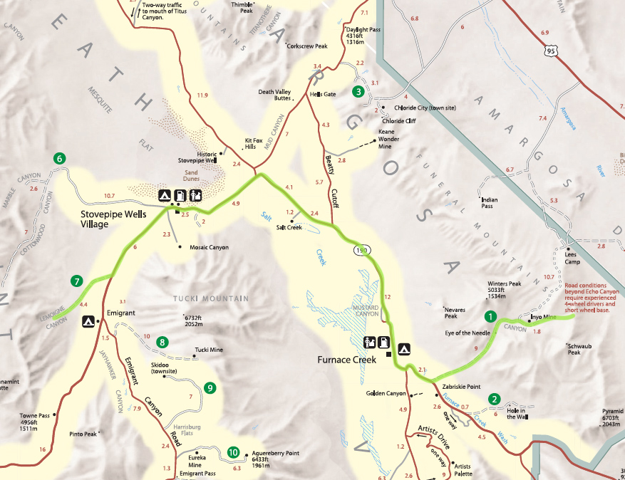
Today we're driving to Echo Canyon in the Funeral Mountains, hopefully making it to Inyo Mine and camping either near the mine or on a side road, for one or two nights. The road beyond Inyo Mine to Lees Camp has a couple of dry falls that are probably the most serious 4WD road sections in the park. The books made them sound so ominous we never dared try them, but this year with two very capable vehicles we felt ready. However, I wanted to save that section for the morning so we'd have a whole day in case we got into trouble, so for sure we would camp on the Inyo Mine side of those falls tonight.
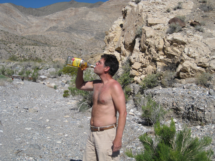
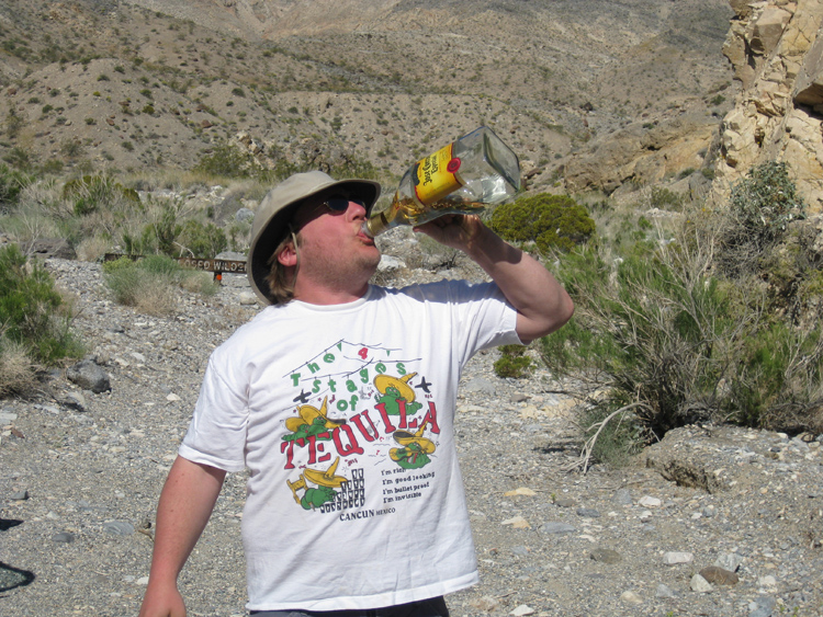
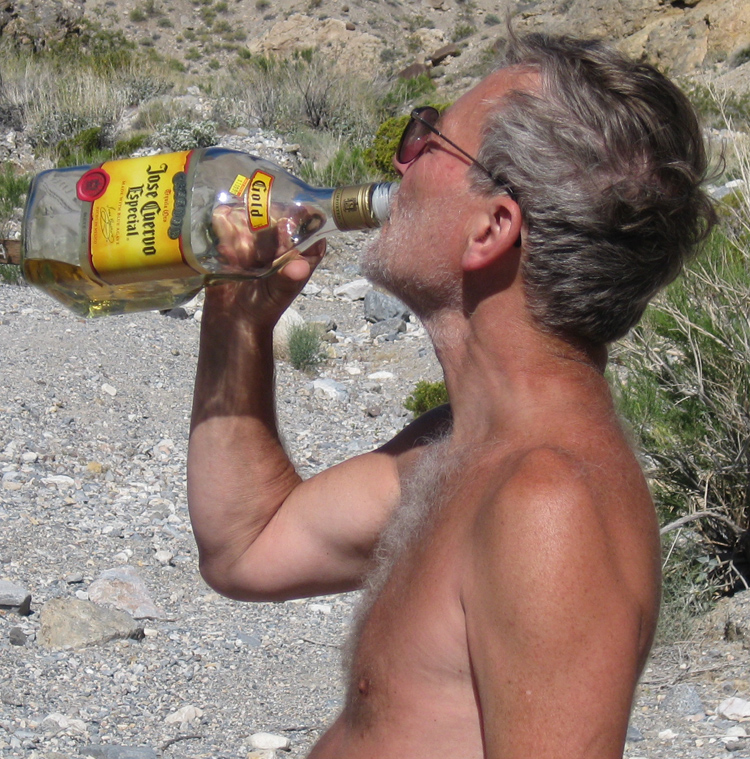
This morning’s breakfast was french toast, which we finished around 8:30 am. By 9:00 am we were in the final stages of packing, but I thought it would still be an hour before we could leave, if we were lucky. Again, because of the bees, we didn’t have our usual morning eye opener with lime and salt, but were forced to swig tequila (not just the mix) directly from the jug. The weather was pleasant, clear and 70° in the shade.
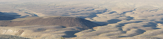
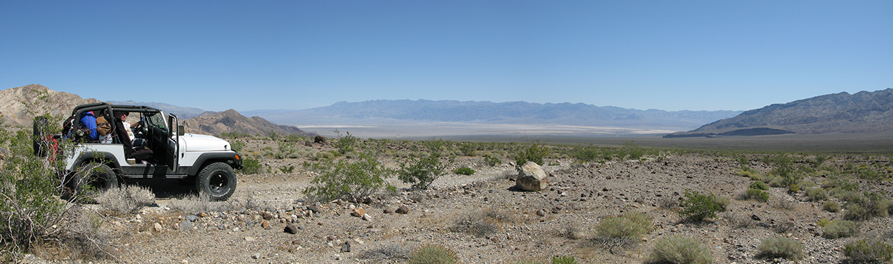
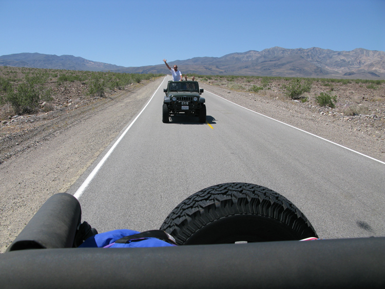
At 10:11 am we were driving, a pretty early start compared to previous days. As we descended the bumpy road out of Lemoigne Canyon we could see Death Valley and tonight’s destination, the Funeral Mountains, beyond. It took us just over an hour to get back to CA 190, and in 6 more miles of highway driving we arrived at Stovepipe Wells, a small outpost with a store and tourist accommodations. Also here was a National Park automated pay station, where Joey and Bobby bought a pass for a week. I had my senior pass, so it was free for me and Danny. We don’t always manage to get to a place to pay the park fee, because there are only a handful of places (I know of just 2, actually) to buy passes, but we pay whenever it’s convenient.
Death Valley and Funeral Mountains from Lemoigne Canyon
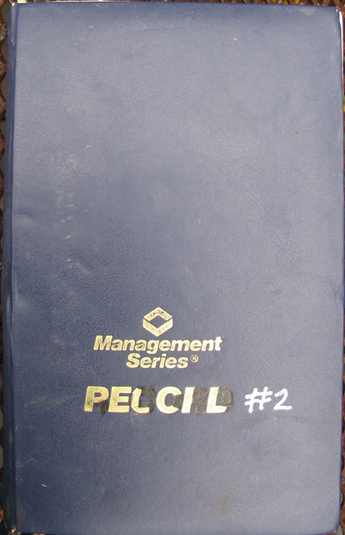
The mission at Stovepipe Wells was simple: top off the gas, buy eggs, refill the drink cooler with ice (which had all melted), and let Joey make a phone call home, which he promised to do in the middle of the trip if we had a chance. If we could do all that here, we wouldn’t have to stop at Furnace Creek, a much more daunting stop in civilization after several days in the desert. We succeeded in all but the phone call—there was no phone! But while others were in the store, I noticed a disaster: Pelcil, my hand-written logbook of all Greenshit trips since 1994, was floating in a pool of water on the floor of the passenger side of my jeep. Every page was thoroughly soaked, and many of them were written with a pen whose ink runs. I spent the next 20 minutes in the hot sun, carefully separating pages one-by-one on the hood of my jeep in an attempt to keep them from gluing together as they dried. That part worked, and many pages remained very legible, but on some pages the ink had been washed almost totally off. I could not determine where all that water had come from, but obviously something in the jeep had leaked.
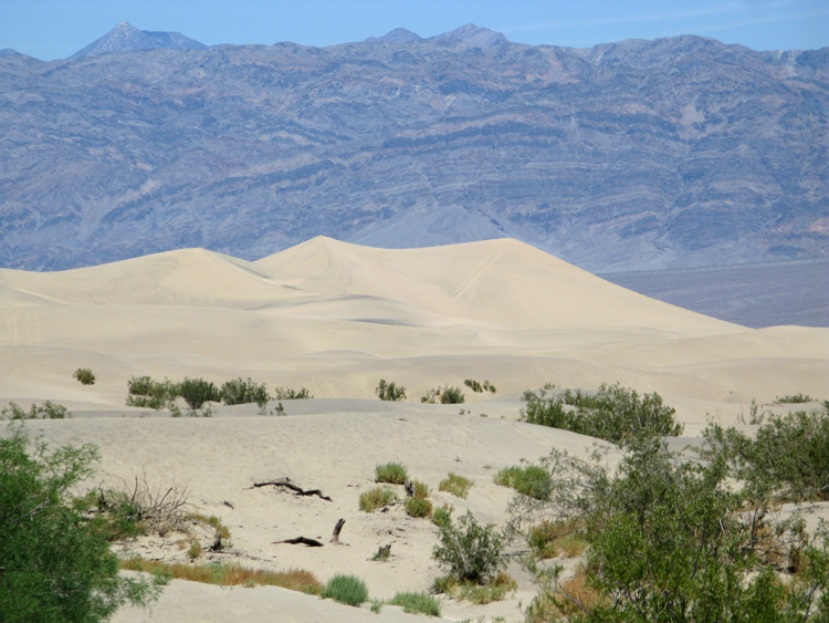
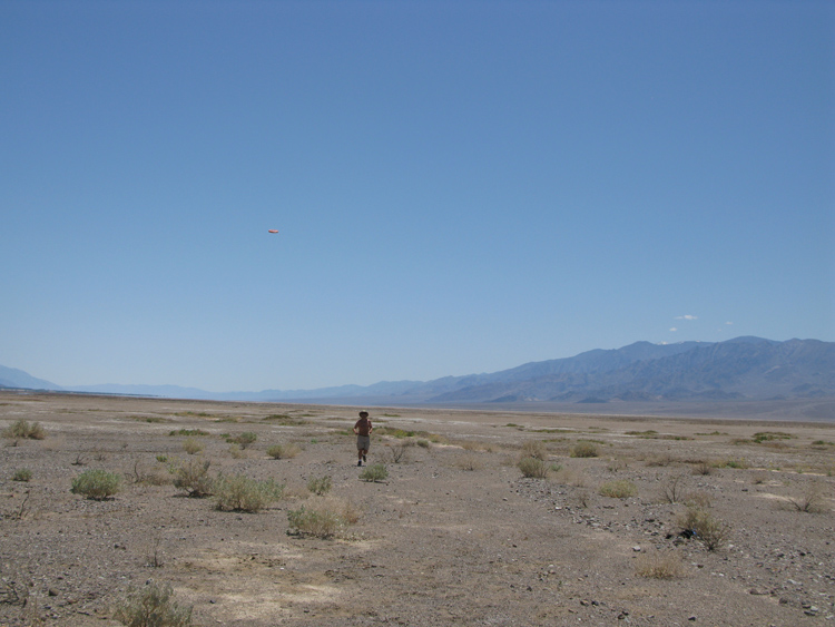
At 12:12 pm we left Stovepipe Wells, and 3 minutes later we stopped at The Sand Dunes, the large and most easily accessible dunes in the park. We don’t normally stop at tourist destinations we had visited in the past, but Danny promised to bring back some Death Valley sand to Dylan, so with baggie in hand, we walked out to the dunes just a few feet from the dunes. Mission accomplished: we spent less than 15 minutes there and were driving again 12:25. We only drove for 16 minutes when we saw an irresistible Frisbee field in a flat gravelly wash. It had only a few sparse shrubs, maybe salt bush. Actually what really attracted us to this area was a whitish salt flat, a bit farther from the road, but the salt flat turned out to be uneven, with a soft crust you would often break through, so playing on the gravel worked better.
We had a some nice tosses for about 30 minutes, with everyone throwing well. At 1:22 pm we were driving again, and in 12-minutes and 8.8-miles we reached Furnace Creek. Total stopping time there for Joey’s call home was just 4½ minutes: because nobody was home, he just left a message. We arrived at the Echo Canyon Road at 1:44 pm, 3.3 miles and 6 minutes from Furnace Creek. The dirt road is unmarked and you would never notice it driving down the highway, unless you knew exactly where to look. As we turned left, I was hoping we had seen the last of pavement (and people) until the end of our trip.
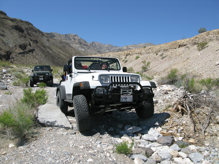
The Echo Canyon Road was easy, but slow and rough, though much faster than Lemoigne Canyon. The first part is on relatively level terrain easily doable by car. Along the way, Joey, in the rear jeep, radioed about gas fumes coming from my jeep. I stopped to look for a gas leak on the ground underneath us, or leak in our jerrycans, but saw nothing. Anyway I tightened the caps a bit.
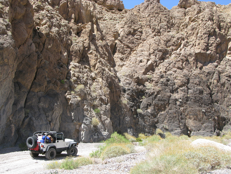
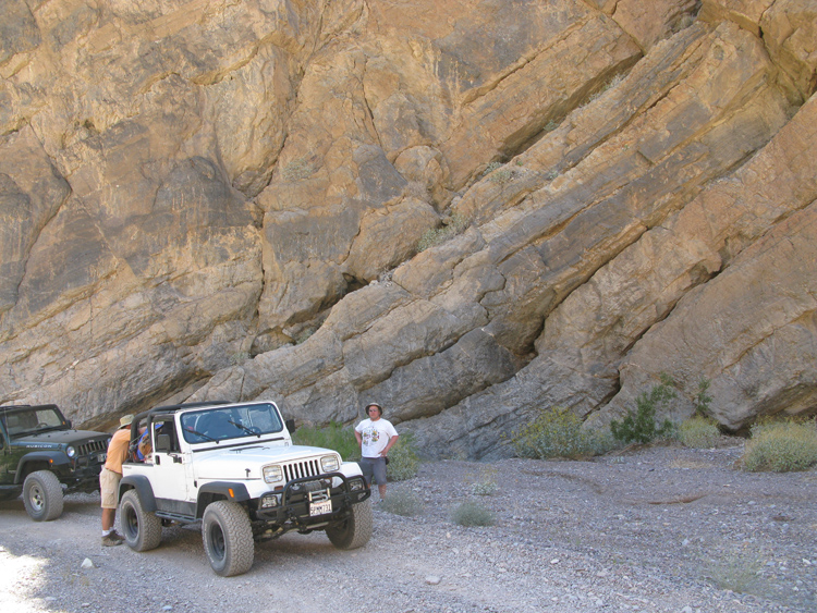
The road, despite its suitability for street vehicles, was still bumpy enough that it took us 26 minutes to drive the first 3.4 miles to the head of the canyon. I had been up Echo Canyon a number of times, and there was always a short but pretty rough spot over rocks, just before the head of the canyon, that would turn away most people in normal cars. But this time I could not find the spot. Similar to what we had experienced on Lookout Mountain, those bumps seem to have been repaired and now any vehicle could pass. I was disappointed, as I thought this would mean that hordes of people would be driving up the canyon, but it turned out not to matter—we saw only one person the rest of the trip, a guy on a dirt bike who would not have been stopped by such a minor obstacle anyway.
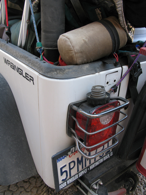
Soon inside the mouth, Echo Canyon got narrower, windy, and very scenic. About 10 minutes into the canyon, I got out to take some pictures of the jeeps in the narrows, while Danny drove around a bend. When I returned to the jeep, I noticed our gas cap was just lying loose, upside down on top of the taillight! It had been there since Stovepipe Wells! This explains the gas smell—how dumb that I didn’t notice this before when I looked for leaks. But most amazing was the fact that the gas cap was still there. Jeeps aren’t known for particularly smooth suspensions, but the cap, held in place only by the plastic ridge of the taillight, did not bounce off on the 60 mph highway drive, nor on the bumpy Echo Canyon road. To celebrate our relief at not losing the cap, we went to excruciating pain to extract a set of beers from the bungied-down cooler.
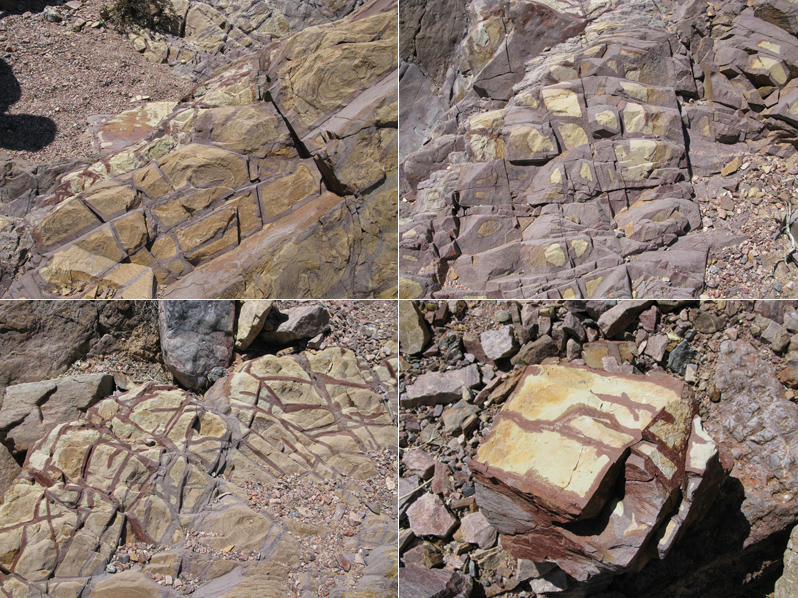
In the next 7½ minutes we drove another 0.8 miles as the canyon got deeper. At 2:41 pm we stopped again to hike up an interesting little side canyon on the left. At the end of this we saw some amazing smooth color patterns in the rocks, both geometrical (reminding me of cave boxwork) and wavy and organic. The debate ranged on as to whether these colors were on the surface or all the way through.
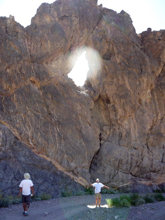
After a 24 minute diversion were were back in the main canyon, and immediately saw the Needle’s Eye, a natural arch (actually, a large hole) high up in the wall. That entire area of the canyon was in the shade except for the beam of sunlight shining through the arch.
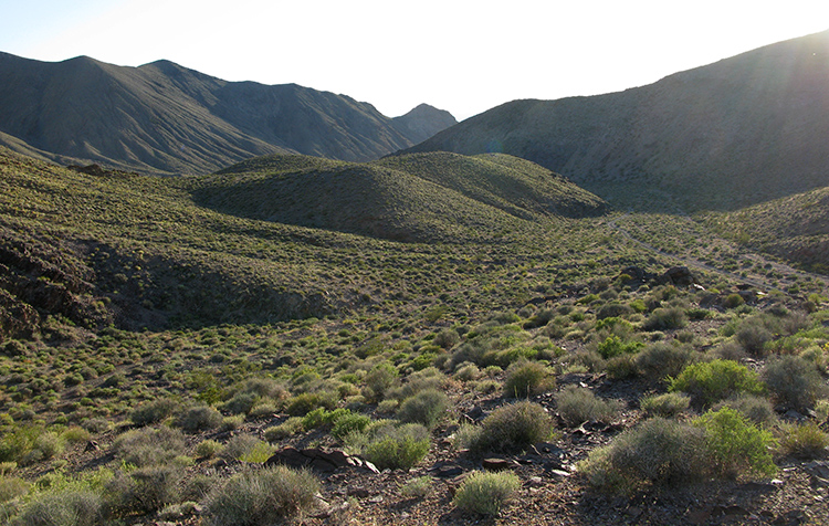
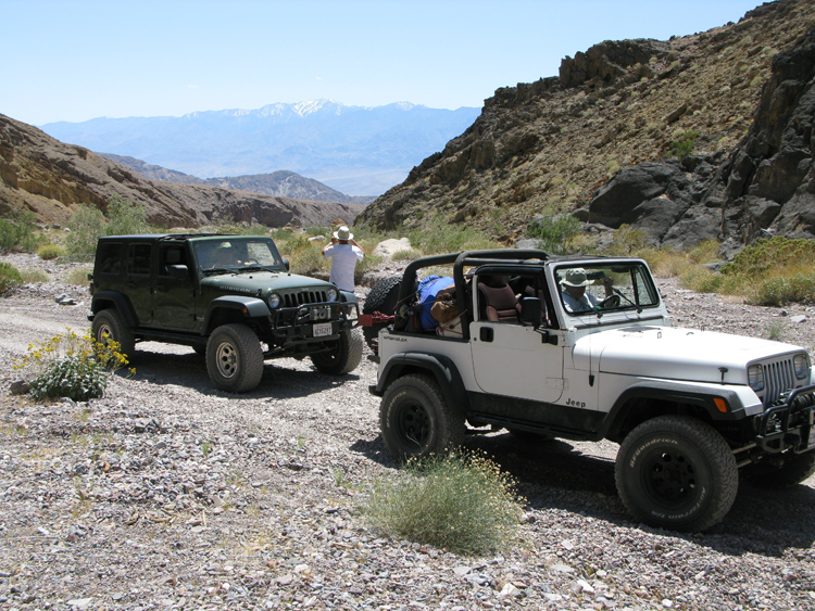
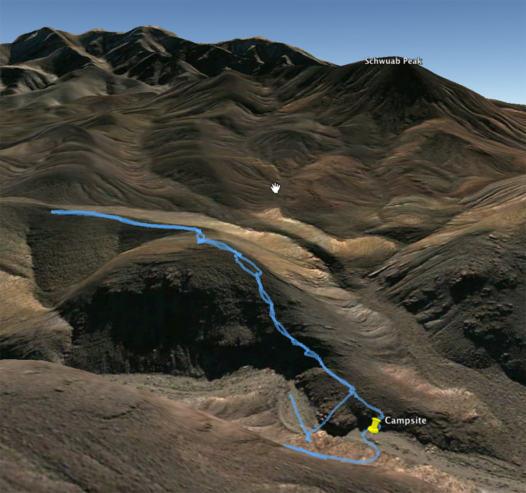
Back in the jeeps, we drove another 4.3 miles in 27 minutes, and at 3:33 pm we reached a junction. To the left was the continuation of the Echo Canyon Road over the dry waterfalls to Lees Camp where we were headed tomorrow, and to the right was the spur to Inyo Mine where we were going today. We reached the mine in 2 minutes, but I wanted to save a visit to the mine for later, as I was interested in first finding a campsite for tonight. Camping right at the mine was not permitted, so we kept driving past the mine hoping to see a good spot nearby where the road ended (I always prefer camping at the ends of roads). I had never been past Inyo Mine and always thought the road stopped right away, but it kept going and going. We drove another 13 minutes and 1.4 miles, until reaching a wilderness barrier blocking the road. Looking at the map more closely, I could see that the original road went for another 3.3 miles beyond the sign to a precipice: the eastern edge of the Funeral Mountains, where the plateau in the mountains suddenly drops into the Amargosa Desert. I realized here was a perfect place to camp, giving us the possibility of a day hike tomorrow to a possible lookout over the Amargosa. For the whole time since Furnace Creek (which is below sea level) we had been slowly going uphill into the Funeral Mountains. Here we were at 4160', and the end of the road to the lookout was just a bit higher at 4600'.
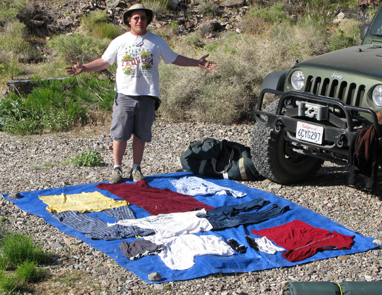
It was 4:00 pm when we began unpacking. When Danny took his duffle bag out of the jeep, everything in it was sopping wet. Now it was clear where all that water in the floor of my passenger seat came from: we had put one of the sunshowers on top of his dufflebag, and during the ride out of Lemoigne Canyon its hose had come off, so almost 2 gallons of water leaked onto his duffle bag, into the rear of the jeep, then ran down to the floor of the front passenger seat. Danny’s clothes were the only things besides Pelcil that got soaked. But in the desert, wet clothes are no problem: just lay them out and in a few minutes they're dry. One way to wash your clothes, I guess.
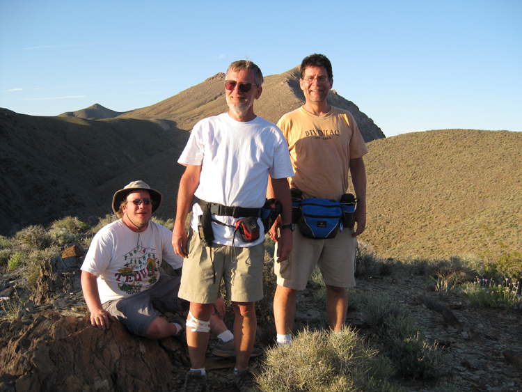
While preparing dinner, a man in a dirt bike drove up. I don’t remember another time in my 10 years visiting Death Valley where someone came to our campsite. He was a nice guy and travelling alone, with no obvious camping or survival gear. He was planning to continue driving some huge distance today before meeting up with his family somewhere. I don’t remember the details of his plan, but I remember thinking it was outrageously ambitious. I'm sure dirt bikes can go a whole lot faster than jeeps, but still I thought his was an extreme plan for this late in the day. We offered him a beer, which he drank, and we talked a bit. For a while I was worried that he was not going to leave, and we needed to get to work with dinner. But eventually he went on his way.
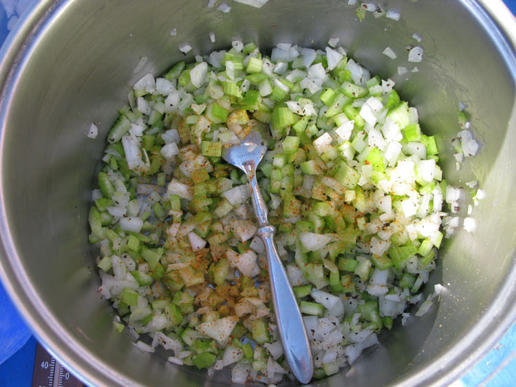
Our first appetizer was beer and canned trout. By 5:00 pm were eating our 2nd appetizer: stuffed mushrooms with garlic from Trader Joe’s. While preparing our dinner of canned tuna salad with onions and celery, we realized that our cheddar cheese supply was getting low, so we began to ration. We were about 8 oz short for the trip, but by adding a slide of leftover bread to this meal we did not starve. Dinner was at 5:20 pm.
After dinner we decided to take an evening hike up to a high point in the hills south of the campsite. While preparing for this, Joey mentioned he replaced the AAA batteries in the walkie talkie I had given him and threw out the old ones. Oh no—they were expensive rechargeable batteries! Fishing them out of the trash was not an option, as we had unloaded the trash in the dumpster at Stovepipe Wells. While chastising Joey for this crime, I realized I had also replaced the batteries in my walkie talkie, and I had done exactly the same thing! Luckily I just tossed the old batteries on the passenger floor of my jeep, and they were still there, wet from the flood, but serviceable.
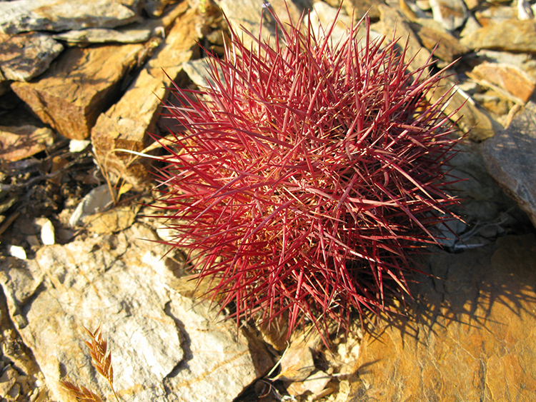
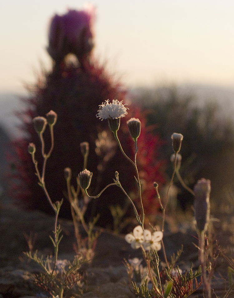
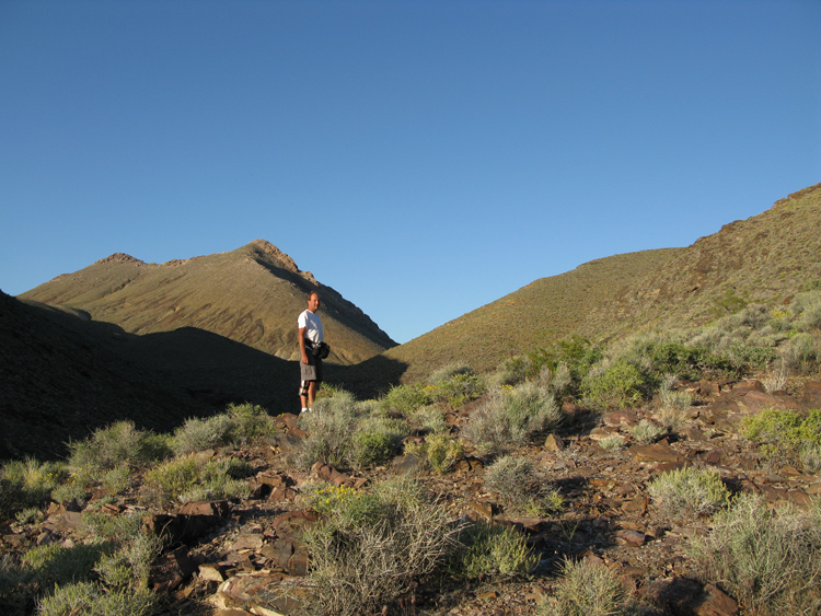
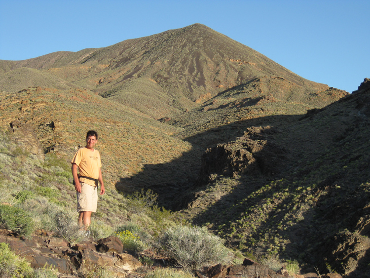
At 6:42 pm, with plenty of light, we began our hike, and 33 minutes later, in a little under ½ mile, we reached the high point overlooking the end of the canyon where we were camped. At this spot we found a cairn, to which we added a few rocks. From here it would be possible to keep hiking farther to the summit of a mountain (later determined to be Schwaub Peak at 6400') if we wanted to make a whole day of it, but we hadn’t yet decided what to do tomorrow. Tonight, we just hiked back down. The return actually took longer, as we stopped several times to look at the scenery and plants in the waning sunlight. There was an especially interesting type of red barrel cactus that glowed by backlight. The round trip hike took 80 minutes, and we got back down to camp as it was getting dark at 8:04 pm.
The next order of business was illuminated Frisbee. From the top of our hike, we had noticed an area just upstream of our camp that looked open, but when we went there the terrain was uneven, so instead (I think) we found a spot downstream where we had some great night tosses despite the obstacles.
 a few rocks. From here it would be possible to keep hiking farther to
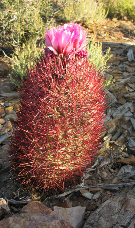