Day 1: July 6 Thursday — East Coast to Moab
Highlights: Fly from Boston and Raleigh to Denver; beer and hamburgers at Denver airport; missing luggage in Grand Junction; beer at Fisher Towers; pick up jeeps in Moab; Greenwell Motel; massive jeep packing; shop at City Market; dinner at Eddie McStiff’s; luggage delivered in middle of night.
Arising to good weather in the wees of the morning, Ed, Terry, Mark and I made our ways from various corners of New England to Logan airport, where we dropped off eight 70-pound duffel bags of camping gear with the sky cap at the United terminal. Still groggy, we had time to meet for a cup of coffee in the cafeteria prior to our 8:10 a.m. departure. Meanwhile, Lou and Chris were already in flight from Raleigh with four additional duffels. I delivered two of those duffels to them months ago, pre-packed with Greenshit equipment, because the airlines only allow two checked bags per person. So far, everything was going smoothly with no near-death experiences.
Being seasoned travelers, the four of us on the flight to Denver reserved aisle seats next to each other, repeatedly getting whacked in the head by the dinner cart as we plotted our adventure. We applied final tweaks to the preprinted meal menu and shopping list and divvied out the Moab shopping chores. I spent half the flight imitating a Xerox machine, making six copies of the updated list.
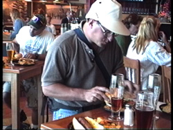
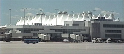
We met Chris and Lou on schedule at the United terminal of the dreaded, spanking new Denver International Airport. DIA is still a place of horrors for ground connections, but for transferring between flights it is quite pleasant, with amenities that can’t be beat.
 |
 |
United Express, operated by Mesa Airlines, flew 48-seat turboprops on the 70-minute flight to Grand Junction. From the window at the gate we saw that at least some of our twelve monstrous duffel bags were being crammed into the small plane. The flight to Grand Junction was unusually smooth, with stunning views of the Rocky Mountains as we skimmed the snow covered peaks.
There were several interesting people on the plane. A 12-year old kid in front of me asked the attendant, “Are you going to treat me like a kid traveling alone and check on me every five minutes?” We chatted with a party planning to shoot a Geo Tracker commercial somewhere in the Canyonlands area. When asked if they were going to helicopter a car onto a pinnacle, they said that kind of thing isn’t cool anymore. But extremely close inspection revealed that selling cars with sexy models is still P.C.
In Grand Junction it was sunny and in the mid 80’s at 1:00 p.m. The modern airport was as deserted as always, except for the forty people on our flight. A Thrifty Rental Car man holding a “Gasser” sign was waiting for us at the baggage claim. Mark and I changed from airplane clothes to Utah clothes (shorts, T-shirts, sandals) and took the Thrifty van to the off-airport check-in facility while the others dealt with the luggage. Thrifty said they did not have two full sized cars that we had reserved, but were offering us an upgrade to Chrysler LHS’s (a “luxury” full size) at the same price ($55 one way, one day to Moab) or Cherokees for an extra five bucks. We decided on one LHS and one Cherokee, which we checked out and drove back to the terminal to pick up the other guys.
Now came the first glitch of the trip: the four bags from N.C. had not arrived—all of Lou’s and Chris’s personal gear and all the Greenshit cooking and eating equipment. After waiting another thirty minutes to see if they were on the next flight, we departed with trepidation, though United swore up and down they would deliver the bags to our motel later in the evening. During the luggage ordeal we sent Mark to pick up some beer for the ride to Moab, some of which we drank in front of the airport, and we set up CB radios on the two rental cars.
Grand Junction lies in flat, arid terrain along the western edge of the Colorado Rockies, with cliffs and mesas to the north, east and south. The first half of the 90-mile drive to Moab is due west on I-70 in the featureless desert just south of the Book Cliffs visible in the distance. I guess they’re called Book Cliffs for the stupid reason that they resemble a shelf of books. As we drove across the desert, something was obviously not right: the normally brown desert vegetation was brilliant green and blooming, with most plants sporting tiny flowers. Usually, July is well into the dry season. This unusual blooming and greenery persisted everywhere in Canyon Country for the rest of our trip. Another interesting observation along I-70 was that the Colorado River, which flows out of the Rockies through Grand Junction, was bursting out of its banks, flooding the neighboring lowlands. Highway bridges were just inches above the water.
I led the way down the Interstate driving the Cherokee. Every five minutes someone in the LHS petitioned me on the CB radio to stop and have our beers. Since our supply was so limited (two per person) I resisted stopping until the next designated drinking site.
I-70 crosses the Utah border at a long downhill run. The second half of the ride to Moab will be on Utah Rte. 128, but just before the exit for 128 there is an exit for a shortcut to 128 on an unnamed paved road that passes through Cisco, Utah. Cisco is a curious ghost town that’s still inhabited. Along the main road all the buildings are vacant, rotted, and partially collapsed, while a side road leads to a cluster of trailers where the remaining residents live. The community does not look healthy. On the road to the trailers there is a crude sign reading “This is not the way to Moab,” probably put up because people coming this way are aiming for a left turn onto Rte. 128. It is possible that Cisco was once the first metropolis west of Grand Junction on the old U.S. Rte. 6 before they built the Interstate to bypass it. Now its gas station and store are dried out shells disappearing into the dust. A few miles past Cisco is the real junction with 128.
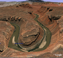 |
Also known by locals as the River Road, route 128 turns south, back to the Colorado River which I-70 departed outside Grand Junction, crosses the river on the 40-ton load limit Dewey Bridge (the only river crossing between Grand Junction and Moab), and then winds its way along the south bank of the river a few feet above the water. Immediately after the bridge the river begins carving its first sandstone canyon since leaving the Rockies. As we drove downstream, the canyon walls above us rapidly became higher and more vertical, until they were 2000′ feet high, nearly hugging the banks and almost pushing the road into the river.
In a few miles the walls suddenly receded into the distance and the canyon opened up to Richardson Amphitheater, a wide valley ringed by cliffs with buttes and spires in all directions. The 12,000′ snow-capped La Sal Mountains looming in the south made for a striking contrast to the red sandstone walls of the valley. The mountains were unusually white for this time of year.
 |
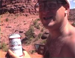 |
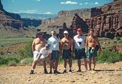
One set of pinnacles on the left is Fisher Towers, a famous postcard subject and popular rock climbing area. We drove down the two-mile dirt spur road to the towers, hoping to see some climbers, but the parking area at the end was deserted. Climbers or not, this was our designated beer drinking site. Here we took the requisite “before” picture of our group with the magnificent Colorado canyon as a backdrop. Our first desert air measurement registered 96° with 15% humidity on my electronic thermo/hygrometer, and to experience this we spent a half hour walking a short trail toward the towers. We didn’t go all the way to the towers, but I climbed down 90′ into a little canyon and got even more acclimatized by rubbing some sand into my pores.
Our diversion at Fisher Towers inspired an intellectual exercise that provoked discussion every day of trip: what’s the difference between a butte and a mesa? For that matter, throw in knolls, pinnacles, spires, needles and fins. I’m not even talking hills, mounds or mountains.
After the little hike we returned to Rte. 128 and continued south. The distant canyon walls rapidly closed in again, squeezing the highway onto a narrow strip of land next to the river. As recently as the late 1970’s, Rte. 128 was a scary one lane dirt road carved into the cliffs above the river. Now it is a modern two-lane highway suitable for Winnebagos and Mack trucks, but it remains one of the more beautiful highways in the country. During this hour-long drive we saw scores of rafters, canoers and kayakers who put in at points along the road and take out at Moab. There is some moderate white water here but nothing that looks like a serious challenge. There are also many little campsites between the river and the road. At times, the high water appeared threatening to both these campsites and us. In 1983 this road was closed during spring floods. Most of this river shoreline was recently dubbed the Colorado River Waterway, which appears to be an excuse to spend money building bathrooms and campsites along the river and imposing rules on where people can sleep, which serves to attract even more people.
Near the end of the River Road the level of activity increased as we saw more cars, rafters and bicyclers. Just before the intersection I pointed out the official Greenshit watering hole, a pipe coming out of the left wall spewing a good flow of water (about a quarter fire hydrant). This is Matrimony Spring, touted by locals as the best water in town. During the popular season there is usually a line of campers and bikers filling their jugs. Immediately beyond the spring the canyon walls disappeared from both sides and we (the road, and the river) punched into the side of Moab Valley.
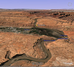 |
Moab Valley is a north-south valley about 20 miles long, and is cut in half by the Colorado River that crosses it east-west, with the town of Moab occupying most of the valley south of the river. The Colorado gorge that continues west of Moab Valley has thousand foot-high walls with barely enough room along the banks for a two-lane road on each side. The east edge of Moab valley where we entered consists of sandstone cliffs and foothills of the La Sal Mountains, and along the west edge are continuous thousand foot high sandstone cliffs broken only by The Portal, the name for the cut made by the Colorado River gorge. The Portal is the gateway to much of the Canyonlands region. The rugged high country on top of and behind this wall is called Behind-the-Rocks.
A valley such as Moab Valley, with a river that cuts it crosswise, is called a paradoxical valley, because normally rivers run along valleys. Paradoxical valleys are quite rare: they are formed when a strip of land perpendicular to the river sinks long after the river has already formed its canyon, so the river continues on its course even while a new valley is forming across it. Eventually the new valley may become wider than the original canyon, but the original canyon remains a little deeper and retains the river. In the case of Moab Valley the Colorado River itself causes the sinking by dissolving buried salt deposits (paradox formations) on either side of the river that originally supported the overlying rock, so as the Colorado River carves a deeper gorge, Moab Valley sinks in tandem. There is another paradoxical valley over the border in Colorado whose official name is Paradox Valley with the town of Paradox inside.
Boaters who enter the Colorado from the Portal near Moab have no easy exit until a hundred miles downstream at the Hite marina just after the river turns into Lake Powell. All of this distance is a deep canyon, the bottom of which is the lowest elevation of Canyon Country, 4000′ above sea level at the Moab end. A river trip from Moab to Hite takes rafters several days—maybe as long as a week. Half way to Hite, the Green River joins the Colorado at the Confluence, after its own 100-mile run through Labyrinth and Stillwater Canyons beginning at the town of Green River. The Confluence is accessible only from the river and is one of the remotest spots in Canyon Country. Between the Confluence and Hite the Colorado River passes through 40 miles of Cataract Canyon with its notorious white water. The are hundreds of main canyons and thousands of side canyons branching into the Colorado and Green River canyons along their entire length within this region. Every one of the canyons is isolated and accessible only with great difficulty. There are no communities, paved roads or settlements, except a handful of ranches, in the 6000 square miles of Canyon Country ringed by major highways. Almost all of the land in the region belongs to federal or state governments, and access to the most scenic portions with deep canyons is tightly controlled, either by nature or the government.
The main street in town running down the center of Moab valley is U.S. 191. Moab (pop. 6000 and rising, many times that in the summer) appeared moderately busy this time. Most motels were full, but in contrast to the crazy months of April and May, there were only a few mountain bikers to be seen and the shops were not jammed. (Moab was recently dubbed the “mountain biking capital of the world.”) This level of activity is normal during these lazy, hot months of the year, when most tourists admire the spectacular scenery from the windows of their air conditioned motor homes. But the temperature in Moab was only in the low 90’s, which us hardened Greenshitters found very comfortable.
The Greenwell Motel, a Best Western on the left halfway through town, was to be the Greenshit base camp for the first and last nights of the trip. Greenshit used to book the Ramada Inn across the street, a tradition begun long ago when Moab was a sleepy mining town and there weren’t many motels, but we switched to the Greenwell in 1993 after the Ramada wouldn’t give us the ground floor room we reserved. At the Greenwell we reserved two specific rooms (#36 and #37) on the first floor at the far end of the motel with an empty lot next to it so we would have space for three jeeps, two rental cars and acres of supplies strewn all over the ground. The rooms are nothing special and a little high priced at $105, but fairly big and comfortable, with space for a third rollaway bed. The motel also has a nice pool, but no Greenshitter has ever taken the time to use it.
We reserved three jeeps at Slickrock Rentals. In the 1980’s, there was only one drive-your-own 4WD rental facility in town, the North Main Amoco, run by a crusty old geezer who had a couple of obsolete International Harvester Scouts. Greenshit in 1983 (known crudely at that time as “Jeep Trip”) used that facility on its first three-day trip to Canyonlands. The proprietor greeted me cheerfully with “That’s $1000 for a tow if you break down out there” and refused to accept returns on Sundays.
For the next six years we rented jeeps from Switzerland of America, 150 miles away in the middle of the Rocky Mountains in Ouray, Colorado, because the proprietor Mike Kern or his wife Sandy would pick us up from the Montrose, Colorado airport, thereby avoiding our need for a rental car. Plus, the drive from Ouray to Moab over the 13,000′ Imogene or Ophir passes was a jeeping adventure in itself. Greenshit became one of Mike’s best customers. Interestingly, in 1987, four years after Greenshit ’83, with a Switzerland of America jeep, we had a mechanical problem in Moab and coincidentally stopped at that same North Main Amoco for a repair—and those Harvester Scouts were still there.
But Mike eventually sold the Ouray jeep rental business (probably to someone just like himself), while Moab’s choice of 4WD rentals increased, and Greenshit decided renting a car to get to Moab wasn’t that much of an additional expense. It is also easier to fly into Grand Junction than to Montrose. Today, there are four or five 4WD rental outfits in town, Slickrock being the least slick because it offers aged, beat-up CJ’s with massive truck tires instead of shiny new Wranglers and Cherokees with all season radials and air conditioning. But the most curious coincidence, when we first visited Slickrock two years ago, was its location: that same North Main Amoco!
After checking into the motel, we sprang into action. Three of us took one car to Slickrock Rentals to get the jeeps while the others began unpacking gear in the lot. The Slickrock proprietor, Rick, was as friendly as usual and as busy as usual with customers that seem to converge on him at 4:30 in the afternoon. He had his brown and white Scramblers ready for us. Scramblers (also known as CJ-8’s) are just like CJ-7’s but with a slightly longer wheelbase and longer rear end. The white Scrambler had caused Greenshit ’94 some difficulty because its extended bumper and trailer receiver, which substitutes for a reinforced skid plate that the brown one has, kept getting smashed on the rocks until it bent. Also, the jeep was prone to stalling at inopportune times. Rick said he fixed the stalling problem, but the bumper was still there and still bent. However Rick raised the body two inches for us, and this turned out to make a world of difference—not once did we bottom out or scrape the rear end. The brown Scrambler is Rick’s and the Greenmeister’s personal favorite, extensively modified for expedition use with a larger gas tank and lower gear ratio. Despite 150,000 miles on the odometer, I trusted that beast the most. For the third jeep he offered us the choice of a red CJ-7 or a Wrangler. We accepted his suggestion to take the CJ-7 because the newer Wranglers are not as good off road, or to quote Rick, “junk.” The optional equipment we requested for the jeeps included no doors, no back seat, and no top. The only nonessential accessory was a bikini top to protect the driver and passenger from sun or rain, assuming it was coming straight down.
Rick loans camping equipment as well as jeeps. One surprise was that he had twice as many water jugs as we expected—eight or nine five-gallon jugs. Together with the jugs we brought in our luggage, this would mean enough water for showers almost every day. In addition we picked up six gas cans, a propane stove, two medium coolers, jumper cables, a tow strap and spare transmission fluid. He also suggested we buy three cans of oil at his expense to take with us. The cost of the jeeps is a sliding scale that ranges from around $60 for the first day to $45 for the last few days.
In a half hour we said good-bye to Slickrock Rick and returned to the motel. A major intellectual challenge of each trip is naming the jeeps, a task even more important this time with our three jeeps because we needed CB handles to distinguish them. Since Ed had accidentally brought a Harpoon Ale sticker from Boston which he stuck onto the fender of the CJ-7, we christened that jeep Harpoon. In keeping with this nautical theme and perpetuating the confusion between Captains Ahab and Moab, we named the white Scrambler Great White (whale, not shark) and the brown Scrambler Pequod (Captain Ahab’s boat, the object of Moby Dick’s distress).
Back at the motel the cars were unloaded and it was time to shop. Each item on the shopping list was labeled with a person’s initial, so that each person could buy the items for the two dinners they were planning plus a share of everything else. I made these assignments based on whom I could trust to buy what. For example, Ed was assigned the booze. However, instead of all six of us shopping at once we decided it would be more efficient if we sent Mark and Chris to Matrimony Spring in a jeep to fill the water jugs while the other four of us took a car to City Market two blocks away for the shopping. This decision was based on previous experiences where it took a very long time to fill up the jugs. However this year the spring was gushing so fast that the jugs were full in no time, while shopping took forever—an hour and a half. One problem was that nobody was familiar with the store, and the shopping list was not in the order of the aisles. This meant that all four of us had to visit and revisit every point in the store several times, using a method not much better than random walk. Sometimes four of us would converge to grab neighboring items off the same shelf. In addition, Moab’s largest supermarket, though very respectable, was not as well equipped as the typical New England superstore, so we could not find some items, necessitating a last minute change of menu.
Food stores in Moab sell beer and wine, but the beer is only 3.2% alcohol, or “Mormon Brew” as Edward Abbey calls it. This lightweight beer is perfect for the desert, where you need liquid more than alcohol, and at 110° you don’t notice any deficiency. But Ed’s portion of the shopping included a stop at the state liquor store to pick up one case of the real stuff for an occasional evening treat.
Buying groceries for six people for ten days is not like your average shopping trip. If a person uses one of something per day, that’s 60 of them for the trip. A mere two cans of fruit juice per day, one for breakfast and for the afternoon, meant buying 120 cans for $100, filling up a shopping cart and emptying the poor supermarket shelf.
All together we spent $800 in groceries and liquor, nearly exhausting our first deposits into the kitty. Total ice for the three coolers was nine blocks. This purchase did not constitute all of our food for the ten days, since we were planning to stop in the town of Green River three days later for more ice and food.
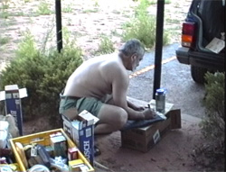 |
When we met back at the motel, three people took a jeep and the two rental cars to Thrifty to return the cars while the others packed the coolers and the remaining jeeps. We rapidly customized the jeeps with seat covers, CB radios and other instruments, fastening everything with duct tape. Working with the efficiency of a team training together for months, we unpacked all the bags and mostly organized the jeeps in a record 60 minutes—on most expeditions final organizing does not happen until the first night on the trail. By 7:30 p.m., we all had showered in the motel and were ready to eat.
Dinner was a few doors away at Eddie McStiff’s, a microbrewery serving concoctions like jalapeno and raspberry beer in addition to the standard ales and lagers, all of which were very good, in a pleasant open air patio. The food, typical southwestern style, was excellent and everyone left full and satisfied.
After dinner, Lou spent a long time on the phone in our room bawling out the United Airlines agent for not delivering our bags yet. The bags, found hours ago, were still sitting on the tarmac in Denver. Nobody had bothered to load them onto any of the hourly flights to Grand Junction.
By 10:30 p.m. we were ready for a long, solid doze. Sometime during the night a man showed up at our room with the bags. Lou thought the man acted like he deserved a big tip for driving 180 miles in the middle of the night. Perhaps he did, but it doesn’t seem right that we should have to shell out because of the airline’s incompetence.